
Via CartoDB — Williamsburg in Monochrome: A Photographic Map
I. The premise for my mapping project draws its inspiration from our running class dialogue about the complicated ways in which we must all negotiate our subjectivity when leveraging digital software and tools to design and build maps. So, in approaching the praxis mapping assignment, I found that my core aim was to wrestle with the interplay between subject/object by integrating cartographic methods with monochromatic photography, in turn juxtaposing the overhead vantage point of traditional cartography with the first-person standpoint and embeddedness of photography. Intending to embrace a more reflexive and intimate approach to mapping, in other words, I wanted to challenge traditional cartography by considering the means by which a series of photographs could invite viewers to craft their own personal visual narrative about a geographic space. While I feel as though my project involves more aesthetic ways of knowing than the propositional or analytic epistemologies of traditional mapping methods, I still want to recognize the fact that this approach nevertheless depends on those same cartographic conventions, otherwise I wouldn’t have a prearranged map of Williamsburg to plot each of my black and white photos. I also want to note that while I cannot wholly unlearn the biases or inclinations of my eye as an amateur photographer, I did make a self-conscious effort to capture a wide array of material, ranging from traffic lights and church spires, to convenience stores and ripped fliers, to flagpoles and local graffiti. Taking the urban landscape of Williamsburg as my priority, and with late-stage gentrification as a key thematic focus in my daily routes, I ultimately elected not to embed any photographs of people, if only because I did not want to exploit their likeness for the sake of my project or its associated narratives. (Admittedly, I am also not too skilled at portrait photography.)
II. With the vast majority of us having combed through our fair share of Google Street View, I think I can speak for most people when I say that these photos are decidedly austere in their ~25,500TB attempt at rendering an “immersive geography” of the world, which is to say, the industrial world. To some extent, given the parameters of Google’s on-the-ground approach to cartography, this spare style is understandable and even somewhat expected, but I nonetheless feel as though it is important to the note that the Lovecraftian deity of Google did not shoot these photographs wholesale; rather, these interactive VR panoramas are only possible due to a process called image stitching, in which computer software quilts together an overlapping array of adjacent photographic images. Part of the inspiration for my map plays on this Big Data concept of global mastery — i.e. via capturing and showcasing a three-dimensional rendering of our local “street view” experience of the world — by photographing and mapping Williamsburg through the subjective vision of a single digital camera.
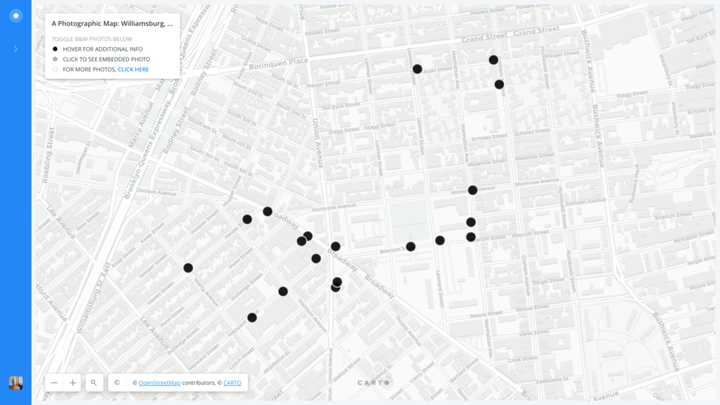
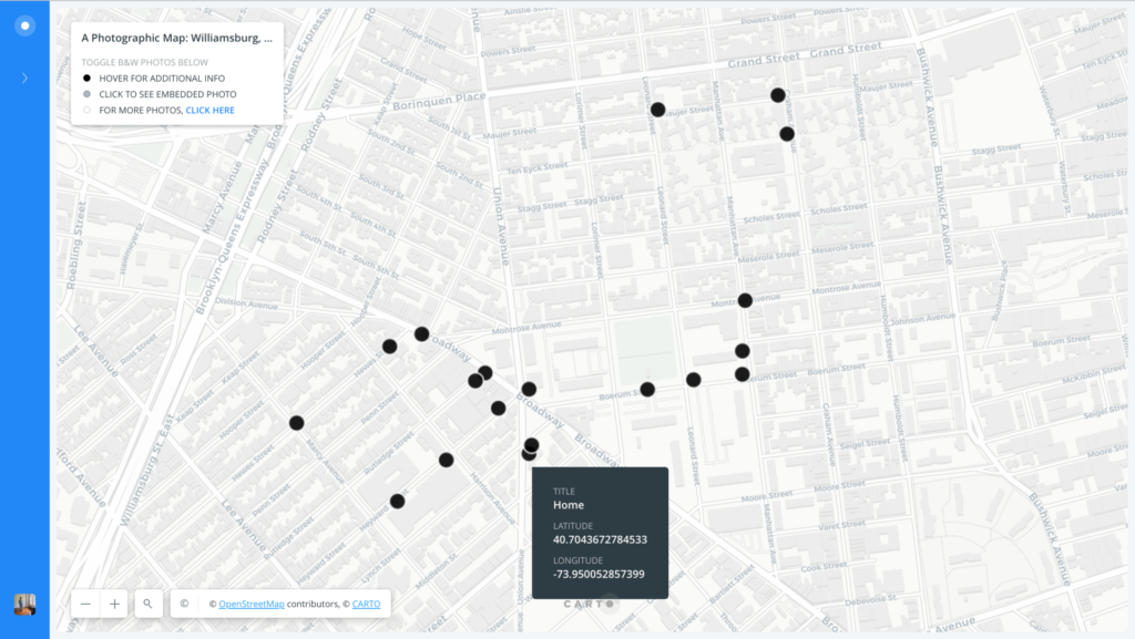
III. The offer a visual overview of my photographic map of Williamsburg, built more specifically with CartoDB, I’ve embedded three annotated screenshots below in order to demonstrate the visual identity of my map as it stands now.

IV. I see this project as a continual work-in-progress — one without an end in sight. In my mind, it is iterative, open to any and all collaborative efforts, reserved to a running state of flux and revision. As we seem to recognize as a class, maps are never subject to completion because the mere concept of “completion” in cartography is a representative fiction — or, better yet, an ever-persistent fantasy of corporate, colonial, and/or national hegemony. As far as my efforts go, in other words, I see this map as a draft in its beginning, ever in process and never quite complete.