
I used this praxis as an exploratory step in what I hope will become a larger project and potentially my thesis/capstone work. Recently I had the opportunity to walk the area of downtown Manhattan that was known during the late 19th and early 20th centuries, roughly 1880-1940, as Little Syria with GC historian and president of the Washington Street Advocacy Group, Todd Fine and music historian Ian Nagoski. I have not lived very long in New York City, so going in my knowledge of the history of this area and people who had lived there was rudimentary at best. That being said, I wanted to learn more about this group of immigrants from the Eastern Mediterranean and their role in the history of New York City, especially as the perception of immigrants from this part of the world remains so highly contentious. I have a background in Islamic/Middle East Studies and Arabic language and have been looking for a bridge to connect my current study of the digital humanities with my previous work in the Middle East. I think this project may just be that bridge.
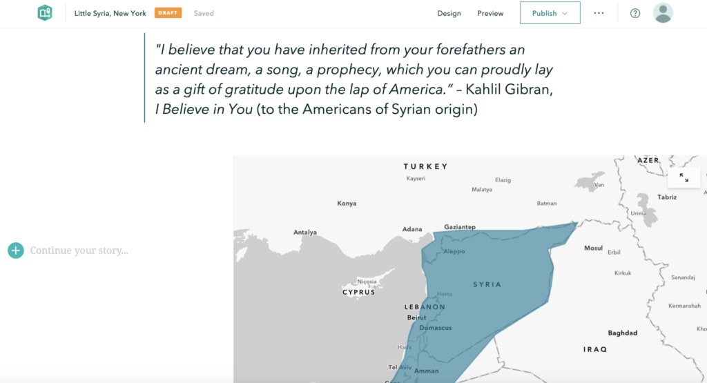
“I believe that you have inherited from your forefathers an ancient dream, a song, a prophecy, which you can proudly lay as a gift of gratitude upon the lap of America.”
– Khalil Gibran, I Believe in You (to the Americans of Syrian origin)
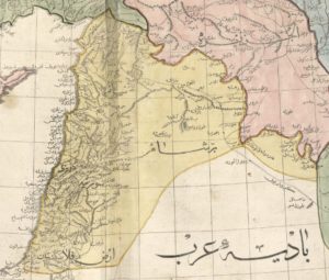
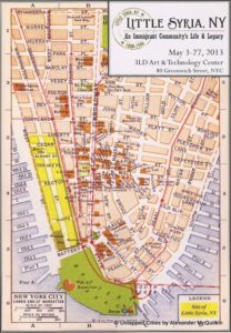
The walking experience of Little Syria was an incredible dive into the physical history of the area which was located on Washington Street, just south of the 9/11 memorial to Battery Park, but it was also an auditory exploration of recordings created by its residents, provided in the form of a playlist by Ian Nagoski. The name Little Syria, can be a little misleading as it refers to the region of Greater Syria, which in the late 19th/early 20th century included parts of Iraq, Israel, Jordan, Lebanon, Palestine, and Syria, and was given to the area because it was the origin point of the majority of the population who lived there. Most of the buildings in Little Syria were demolished when the Brooklyn-Battery Tunnel was built in the 1940s, with just a few buildings remaining, including the St. George Chapel (white building on the right in the picture below, which was designated a New York City landmark in 2009 and is now home to the St. George Tavern).

This walking experience got me thinking about the past and how I might explore the intersections of the history of Little Syria, the history of New York City, the experience of the immigrant’s “American Dream”, and our relationship with immigrants, all within a hauntological (“always-already absent present”) framework (simple, right?!) and could I use some sort of map to do it? I knew that I would not have time to build anything even close to what I envision for a final project, but as with any project, you have to start somewhere.
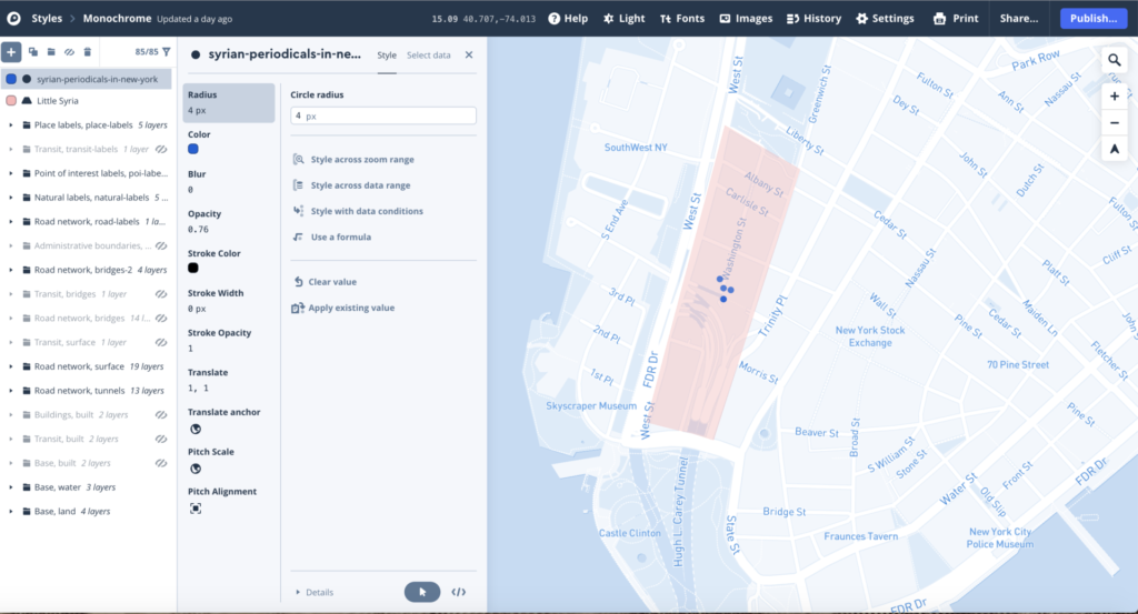
I have experience mapping using many of the applications that we read about in “Finding the Right Tools for Mapping” and I was not sure which would be the best for this project but first I needed some data. I must admit that I fell down many of the same “rabbit holes” that I have fallen down in the past, including spending far too much time looking for data resources, learning there were none and then having to find and build my own datasets which (I knew from past experience) requires a ridiculous amount of time, though I do seem to always underestimate just how long it takes.
I began by playing around a bit in Mapbox with a very small dataset that I built of the locations of Syrian Periodicals in New York based on information from The Syrian American Directory Almanac (1930). It turned out to be nothing particularly exciting so I decided to build something in Storymaps, which was not particularly exciting either.
In the end, I am still not sure what direction this project is going but it was an interesting exploration with mapping applications.